


COORDINATES / KOORDINAT
2.525042° N, 101.800934° E (2° 31' 30.1512" N; 101° 48' 3.3618" E)
LOCATION
Port Dickson is situated 32km from Seremban, the state capital of Negeri Sembilan on its North-East and 50.7km from the Kuala Lumpur International Airport (KLIA) on its North-West. Port Dickson is a coastal district facing the Straits of Melaka. It has white and sandy beaches which have attracted tourists for a long time
LOKASI
Port Dickson terletak 32km dari bandar Seremban di sebelah Timur Lautnya dan 50.7km dari Lapangan Terbang Antarabangsa Kuala Lumpur (KLIA) di sebelah Barat Lautnya. Port Dickson terletak di sepanjang pantai yang menghadap ke Selat Melaka. Pantainya yang landai dan putih menjadi tarikan pelancong sejak dahulu lagi.
TOPONYMY
This place was earlier known as “Tanjung” (Cape, or Promontory in English) by the local Malays due to its location close to a cape. The name, however, was later changed to “Port Dickson” to commemorate the name of a British High Commisioner. Sir John Frederick Dickson was the secretary of the Straits States towards the end of the 19th century. Dickson realised that “Tanjung” had the potential to be a strategic port because of a nearby island called Pulau Arang (or “Coal Island” in English). Pulau Arang produced a lot of coal – so much coal that “Tanjung” was also known as “Alang” or “Arang” by the local Chinese and Indians (http://diamondhill55.blogspot.com/2009/03/asal-usul-nama-port-dickson.html). Dickson also realised that the place was suitable for the British officers and estate managers to spend their holidays. As a result, a 39-km railway track was constructed to ferry products via the port in Tanjung. At the launch of the railway track, the British government announced the change in the name of the cape to “Port Dickson” (http://panitiasejarahsmtsm.blogspot.com/2008/09/asal-usul-nama-port-dickson.html).
TOPONOMI
Bandar yang pada asalnya dikenali sebagai “Tanjung” oleh orang-orang Melayu tempatan kerana kedudukannya di teluk kecil ditukar namanya kepada “Port Dickson” sempena nama seorang pegawai tinggi British. Sir John Frederick Dickson yang telah ditempatkan di Negeri-negeri Selat semasa akhir abad ke-19 bertugas sebagai seorang setiausaha Negeri-negeri Bersekutu Selat. Dickson menyedari bahawa tempat yang dipanggil “Tanjung” oleh penduduk-penduduk Melayu tempatan itu berpotensi menjadi sebuah pelabuhan yang strategik. Ini kerana di situ terdapatnya sebuah pulau (Pulau Arang) yang terkenal dengan pengeluaran arang sehinggakan Tanjung turut dikenali sebagai “Alang” ataupun “Arang” oleh orang Cina dan India tempatan (http://diamondhill55.blogspot.com/2009/03/asal-usul-nama-port-dickson.html). Dickson juga mendapati bahawa Tanjung turut sesuai dijadikan tempat istirehat untuk pegawai dan peladang British. Justeru, sebuah landasan kereta api sepanjang 39km telah dibina untuk membawa barang-barang perniagaan keluar-masuk melalui pelabuhan Tanjung. Semasa perasmian landasan kereta api dalam tahun 1894 itulah pihak British telah mengumumkan penukaran nama “Tanjung” kepada “Port Dickson” (http://panitiasejarahsmtsm.blogspot.com/2008/09/asal-usul-nama-port-dickson.html).
TARIKAN
- Pantai Teluk Kemang
- Pantai Blue Lagoon
- Balai Cerap Baitul Hilal, Teluk Kemang
- Ostrich Farm (Ladang Burung Unta)
- Muzium Tentera Port Dickson
ATTRACTION
- Teluk Kemang Beach
- Blue Lagoon
- Baitul Hilal Observation Centre, Teluk Kemang
- Ostrich Farm
- Port Dickson Military Museum
REFERENCE
http://diamondhill55.blogspot.com/2009/03/asal-usul-nama-port-dickson.html.
http://panitiasejarahsmtsm.blogspot.com/2008/09/asal-usul-nama-port-dickson.html

Pantai Teluk Kemang Port Dickson
Teluk Kemang Beach Port Dickson
 PD Walk
PD Walk
 Pantai Port Dickson
Port Dickson


 |
| KUALA PILAH |
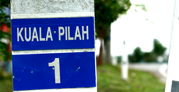 |
| Kuala Pilah is located 37.9km to the east of Seremban via Route 51 and 13.5km to the North-East of Seri Menanti via Route 51 and N24. Kuala Pilah was once the capital city of Negeri Sembilan before Seremban... |


| About | |
| • The Project | |
| • Objective | |
| • Mission | |
| • Partners | |
| Hightlights | |
| • Batak Rabit, Perak | |
| • Desa Temu Jodoh | |
| • Lembah Bujang, Kedah | |
| • Kajang, Selangor | |
| Contacts | |
| info@ukm.com.my | |
| T : +603 8922 8989 | |
| F : +603 8922 8988 | |