KOORDINAT / COORDINATES
Padang Sebang: 2.422593° N; 102.25223° E (2° 25' 21.3342" N; 102° 15' 8.0424 E") Pulau Sebang: 2.447679° N; 102.236128° E (2° 26' 51.6438" N; 102° 14' 10.0602 E")
LOKASI
Padang Sebang and Pulau Sebang is located between Tampin, Negeri Sembilan and Alor Gajah through the M61 Route. Both are located next to Kampung Tanjung Rimau Dalam and Kampung Tanjung Rimau Luar. Pulau Sebang shares its border with Tampin, Negeri Sembilan and is the only place in Melaka with railway tracks crossing it. Padang Sebang, on the other hand, is closer to Alor Gajah. The Melaka River Upstream runs through these two villages. Just like Kampung Tanjung Rimau, a railway line used to pass through Padang Sebang. The tracks were removed during the Second World War following the order of the Japanese army for the construction of the Burma-Siam Death Railway. The tallest hill in this area is Bukit Sebang, and is now a settlement for Orang Asli (the indigenous people). Although both Pulau Sebang and Padang Sebang are located in Melaka, their residents use the Negeri Sembilan dialect in their everyday discourse. This is due to the fact that these two villages are located not far from the Melaka-Negeri Sembilan border.
LOCATION
Padang Sebang and Pulau Sebang is located between Tampin, Negeri Sembilan and Alor Gajah through the M61 Route. Both are located next to Kampung Tanjung Rimau Dalam and Kampung Tanjung Rimau Luar. Pulau Sebang shares its border with Tampin, Negeri Sembilan and is the only place in Melaka with railway tracks crossing it. Padang Sebang, on the other hand, is closer to Alor Gajah. The Melaka River Upstream runs through these two villages. Just like Kampung Tanjung Rimau, a railway line used to pass through Padang Sebang. The tracks were removed during the Second World War following the order of the Japanese army for the construction of the Burma-Siam Death Railway. The tallest hill in this area is Bukit Sebang, and is now a settlement for Orang Asli (the indigenous people). Although both Pulau Sebang and Padang Sebang are located in Melaka, their residents use the Negeri Sembilan dialect in their everyday discourse. This is due to the fact that these two villages are located not far from the Melaka-Negeri Sembilan border.
TOPONOMI
Menurut cerita yang disampaikan kepada Tuan Haji Salehuddin bin Mohd Jai, 84, Padang Sebang mendapat namanya sempena nama sebuah bukit yang berhampiran dengan kawasan tersebut (Bukit Sebang). Di padang tersebutlah berlakunya aktiviti-aktiviti keramaian dalam kalangan penduduk kampung. Pulau Sebang pula mendapat namanya dari sebidang tanah kecil yang terletak di tengah-tengah sawah. Tanah di tengah-tengah sawah ini kelihatan seakan-akan sebuah pulau. Bukit Sebang terletak tidak sampai 1km dari Pulau Sebang dan dari situlah kedua-dua Pulau Sebang dan Padang Sebang mendapat namanya. Klik di sini untuk mendapatkan versi video toponomy Pulau Sebang dan Padang Sebang.
TOPONYMY
According to the stories narrated to Haji Salehuddin bin Mohd Jai, 84, “Padang Sebang” (‘Sebang Field’ in English) got its name from a nearby hill called “Pulau Sebang” (i.e., Sebang Hill). Major social and cultural activities took place at the field. Pulau Sebang (‘Sebang Island’ in English) is also originated from the same hill. It is called “an island” because the raised piece of land in the middle of a padi field looked like an island. This piece of land is less than 1km away from the hill, and that is how, based on stories from the past, Padang Sebang and Pulau Sebang got their names. Click here for a video version of the toponymy of Padang Sebang and Pulau Sebang.
TARIKAN
- Air Panas Gadek (berhampiran dengan Padang Sebang)
- Taman Tema A’Famosa (Pulau Sebang)
- Walaupun kampung ini terletak dalam negeri Melaka, penduduknya bertutur dalam loghat Negeri Sembilan dan adat perpatih, sedikit sebanyak, mempengaruhi amalan harian mereka suatu ketika dahulu.
- Tokoh terkenal: a) Padang Sebang: Tun Abdullah bin Mohd Salleh (1926-2006), bekas Ketua Setiausaha Negara, Presiden Petronas, Pro Canselor UKM. B) Pulau Sebang: Mohd Arif Kendut (Ito Blues Gang), penyanyi (blues) and komposer
ATTRACTION
- Gadek Hot Spring (Close to Padang Sebang)
- A’Famosa Resort & A’Famosa Theme Park (Pulau Sebang)
- Although this village is located in Melaka, the people speak the Negeri Sembilan dialect and their daily practices were once influenced by the Adat Perpatih.
- Famous Figure: a) Padang Sebang: Tun Abdullah bin Mohd Salleh (1926-2006), former Chief Secretary to the Government of Malaysia, Petronas President, UKM Pro Chansellor. B) Mohd Arif Kendut (Ito Blues Gang), a singer (blues) and composer.
REFERENCES
Pulau Sebang. (2013). Retrieved at August 19, 2014 from http://ms.wikipedia.org/wiki/Pulau_Sebang
Salehuddin bin Mohd. Jai.
Sejarah Padang Sebang dan Pulau Sebang. (N.D.). Retrieved at August 19, 2014 from http://rumahwarisanhashimtaharkgpadangsebang.blogspot.com/p/blog-page_25.html
Tarikan Unik di Alor Gajah. (December 1, 2008). [Blog post]. Retrieved at August 19, 2014 from http://myadha.blogspot.com/2008/12/tarikan-unik-di-alor-gajah.html
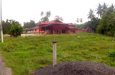
The field where village activities took place once upon a time
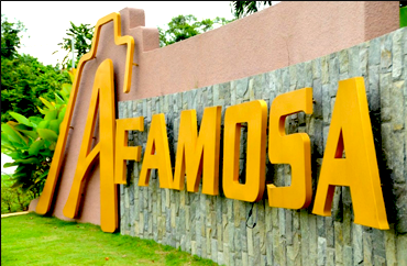 A'Famosa Resort @ Pulau Sebang Melaka
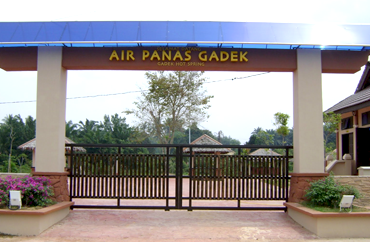 Gadek Hot Spring near Padang Sebang
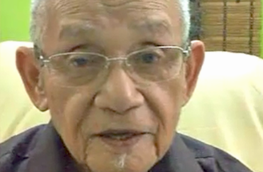
Informant
Tuan Haji Salehuddin 84 years, was born in the year 1930 and lived in the vicinity of Tanjung Rimau til the 1960's. He is a former Headmaster and retired in 1985.
 Famous Figure of Padang Sebang
Tun Abdullah bin Mohd Salleh
Former Chief Secretary, Government of Malaysia, Petronas President and UKM Pro Chancellor
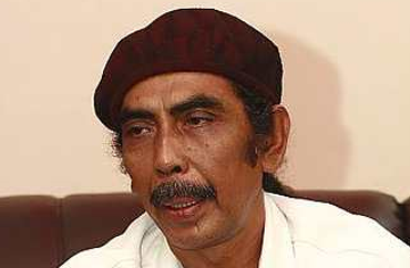 Famous Figure of Padang Sebang
Ito from the Blues and The Gang
Famous Singer and Composer
 |
| DUYONG |
 |
| Duyong is a suburb in the state of Melaka under the Melaka Tengah district (Mukim Duyong, 2012). It is located 5.8km to the East of Bandar Hilir using Route 19 (AMJ Freeway). |
 |
| SEMABOK |
 |
| Semabok is a small town located in the district of Melaka Tengah, Melaka (Semabok, 2014). It is located 5.6km to the East of Bandar Hilir using Route 5. |
| About | |
| • The Project | |
| • Objective | |
| • Methodology | |
| • Socio Economic Aspects | |
| Hightlights | |
| • Batu Gajah, Perak | |
| • Teluk Sari, Johor | |
| • Tanjung Rimau, Melaka | |
| • Pulau Payar, Kedah | |
| Contacts | |
| E: info@heritagemalaysia.my | |
| T: +603 8921 6579 | |


